
C&O Canal: Document View
« previous document | next document »
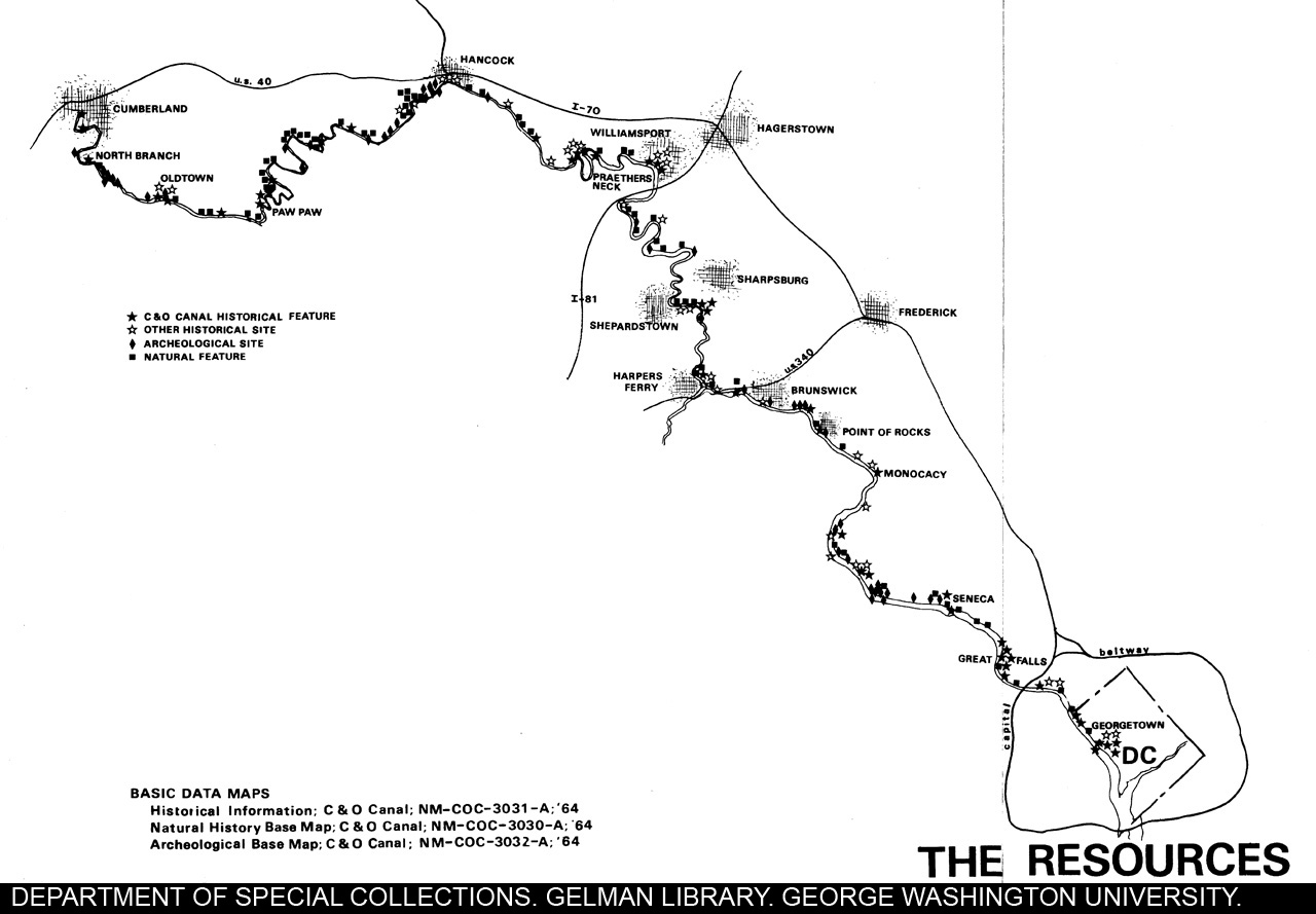
| Title: | Map - C & O Canal and Existing Roadways |
| Author: | |
| Date: | 00/00/1964 |
Document Information
Bibliographic Metadata
| Author: | |
| Title: | Map - C & O Canal and Existing Roadways |
| Date: | 00/00/1964 |
| Archive: | Special Collections, Gelman Library, George Washington University |
| Collection name: | C & O Canal Association Papers |
| Document location: | Box 7, Folder 43, Item 1 |
| Publication location: | |
| Publisher: |
Descriptive Metadata
| Editorial notes: | |
| Description: | A map of the C & O Canal and existing roadways in 1964. The Map shows the canal and its proximity to communities and roads stretching from Georgetown, D.C. to Cumberland, MD. |
| Subjects: | Chesapeake & Ohio Canal Association;; C & O Canal (Md. and Washington, D.C.);; Chesapeake and Ohio Canal (Md. and Washington, D.C.);; C & O Canal & existing roadways;; map C & O Canal |
Technical Metadata
| Date scanned: | 02/27/2006 |
| Person scanning: | T Carter and M. Brach |
| Date converted: | |
| Person converting: | |
| Scanner used: | EPSON Expression 10000 XL |
| OCR program: | |
| Technical notes: |