
Washington Board of Trade: Document View
« previous document | next document »
| Title: | traffic study maps for the Eisenhower Civic Center |
| Author: | Raymond, Parish, & Pine, Inc. |
| Date: | 9/00/1973 |
Document Information
Bibliographic Metadata
| Author: | Raymond, Parish, & Pine, Inc. |
| Title: | traffic study maps for the Eisenhower Civic Center |
| Date: | 9/00/1973 |
| Archive: | Special Collections, Gelman Library, George Washington University |
| Collection name: | the Greater Washington Board of Trade |
| Document location: | Box 237, folder 30, "The Eisenhower Civic Center Project" |
| Publication location: | Washington, D.C. |
| Publisher: |
Descriptive Metadata
| Editorial notes: | |
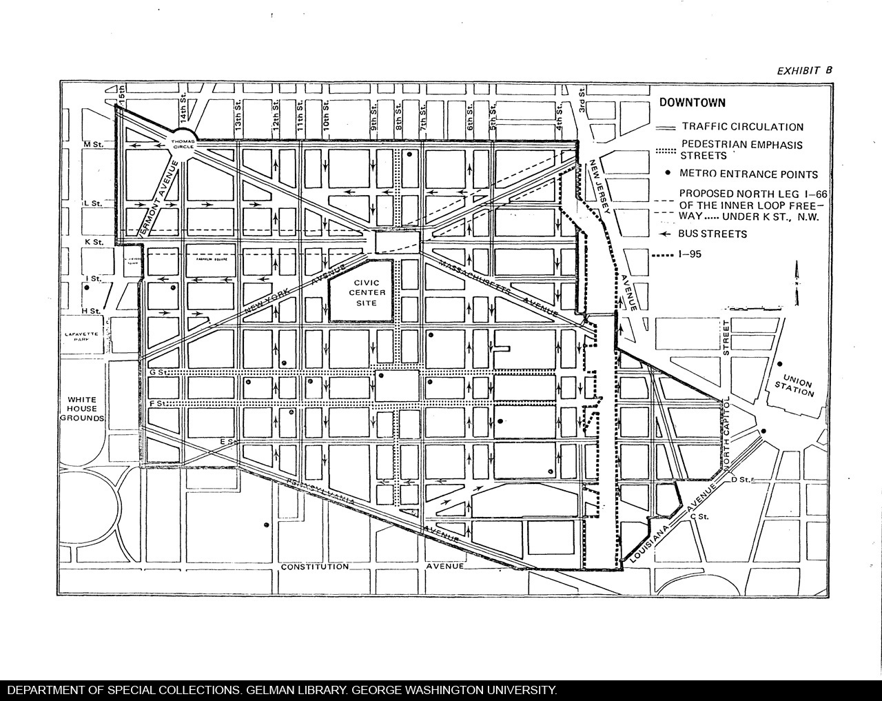
| Description: | During the span of the many years the proposed Civic Center languished on the drawing board, a flurry of studies and reports were produced concerning the project. These are two maps from a traffic study produced by the transportation planning group of Raymond, Parish, & Pine, Inc. These two maps do an excellent job in illustrating specifically where the Civic Center would have been located and the enormous impact that would have been dealt to the Chinatown neighborhood. |
| Subjects: | the Greater Washington Board of Trade;; urban planning;; Washington, D.C.;; Dwight D. Eisenhower Memorial Bicentennial Civic Center;; NHL hockey;; NBA basketball;; Washington D.C. government |
Technical Metadata
| Date scanned: | 3/6/2006 |
| Person scanning: | Craig Clarke |
| Date converted: | 3/6/2006 |
| Person converting: | Craig Clarke |
| Scanner used: | Fujitsu FI-4220C |
| OCR program: | PixEdit 7 Rev. 7.3.6 |
| Technical notes: |